
Into The Buckhorn Wilderness
Day one: Tubal Cain Trailhead to Buckhorn Lake.
The start of the trip was a late one. Annie had to open at work. She was up at 3:50 AM. After she was off and back home, she was able to switch a shift around, and then we were off after that!
Arriving at the trailhead late meant the parking would be a little cramped when we would pull in. It didn’t help that anyone at the trailhead knew how to park, at all.
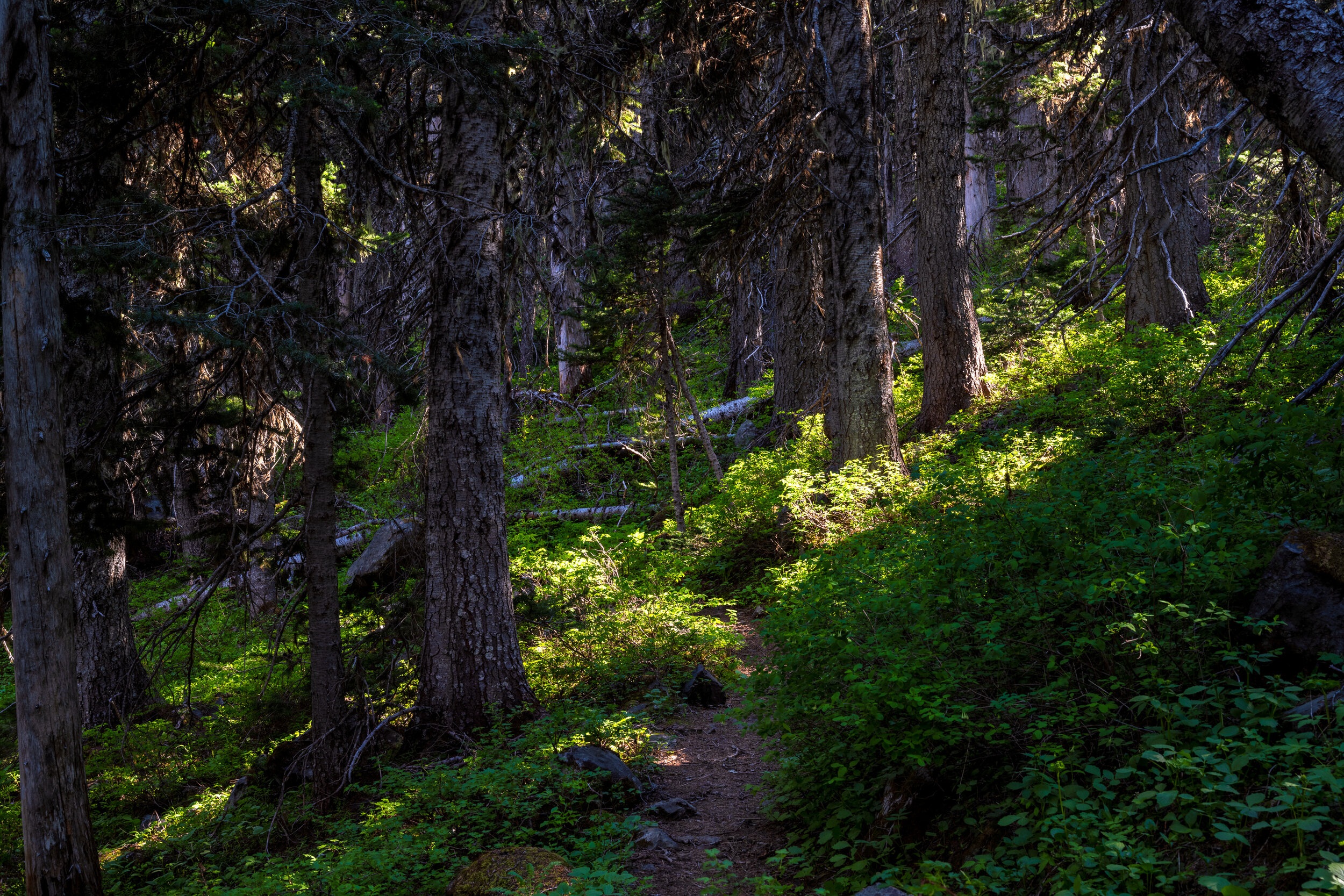
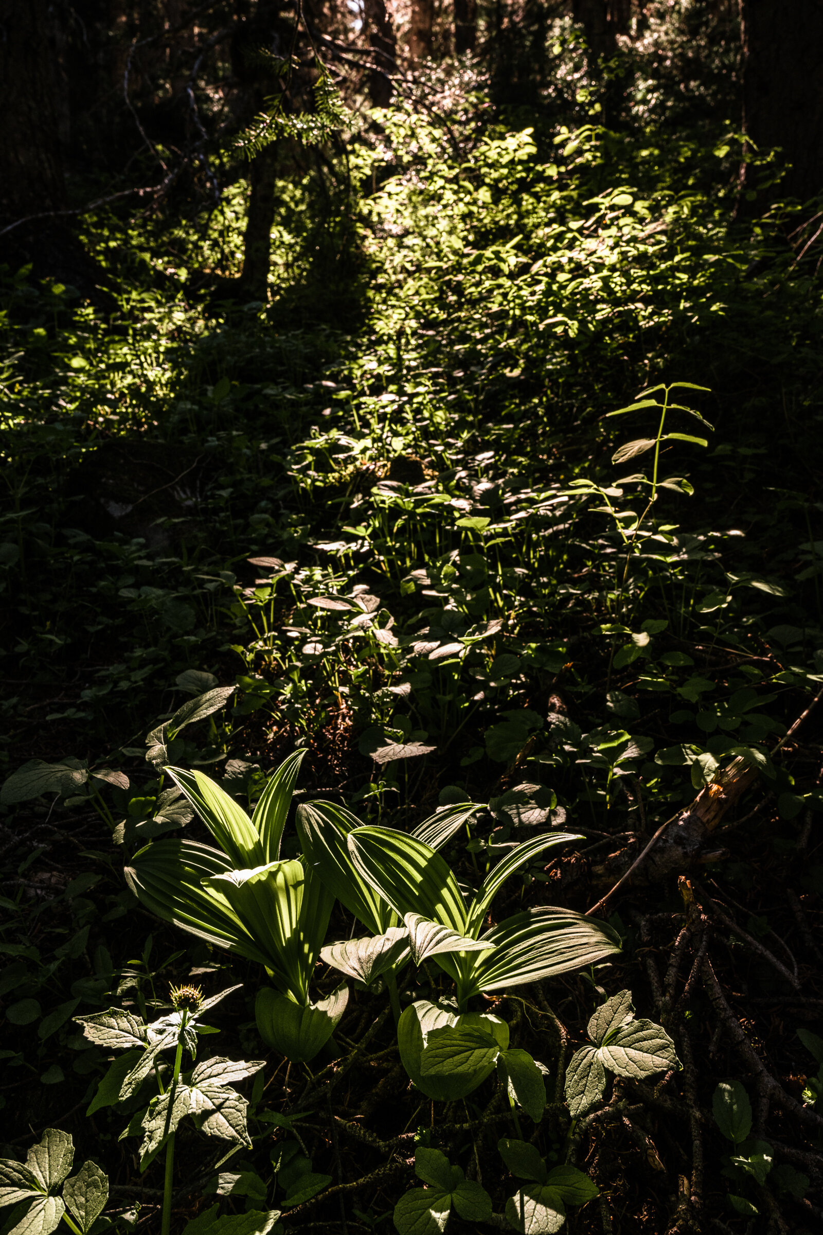
We loaded the last few things into our packs, and we were off into the forest. The first few miles was a gradual climb up through wild rhododendrons that were just about in full bloom. As you make your way up, you have a trail to your left that takes you into Tull Canyon and the Tubal Cain Mine. Tull Canyon is the almost final resting place of an SB-17, a search and rescue variant of a B-17. The SB-17 collided with a mountain ridge en route to a search and rescue operation. A few flight crew members did not survive the impact and slide down into the valley. After the wreck, the fuselage was salvaged and is now one of the two remaining B-17’s that are airworthy.
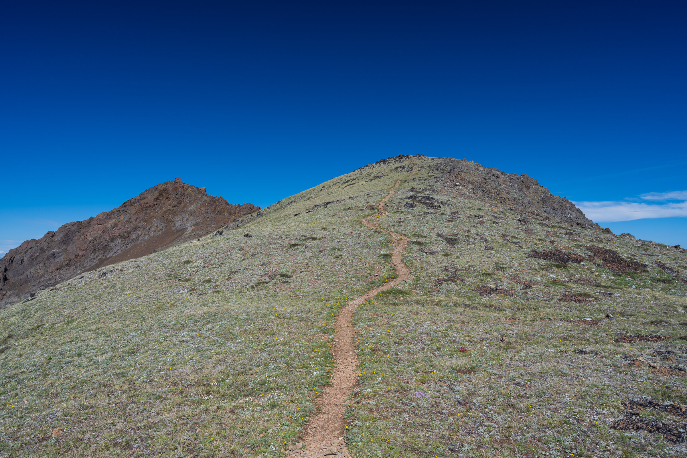
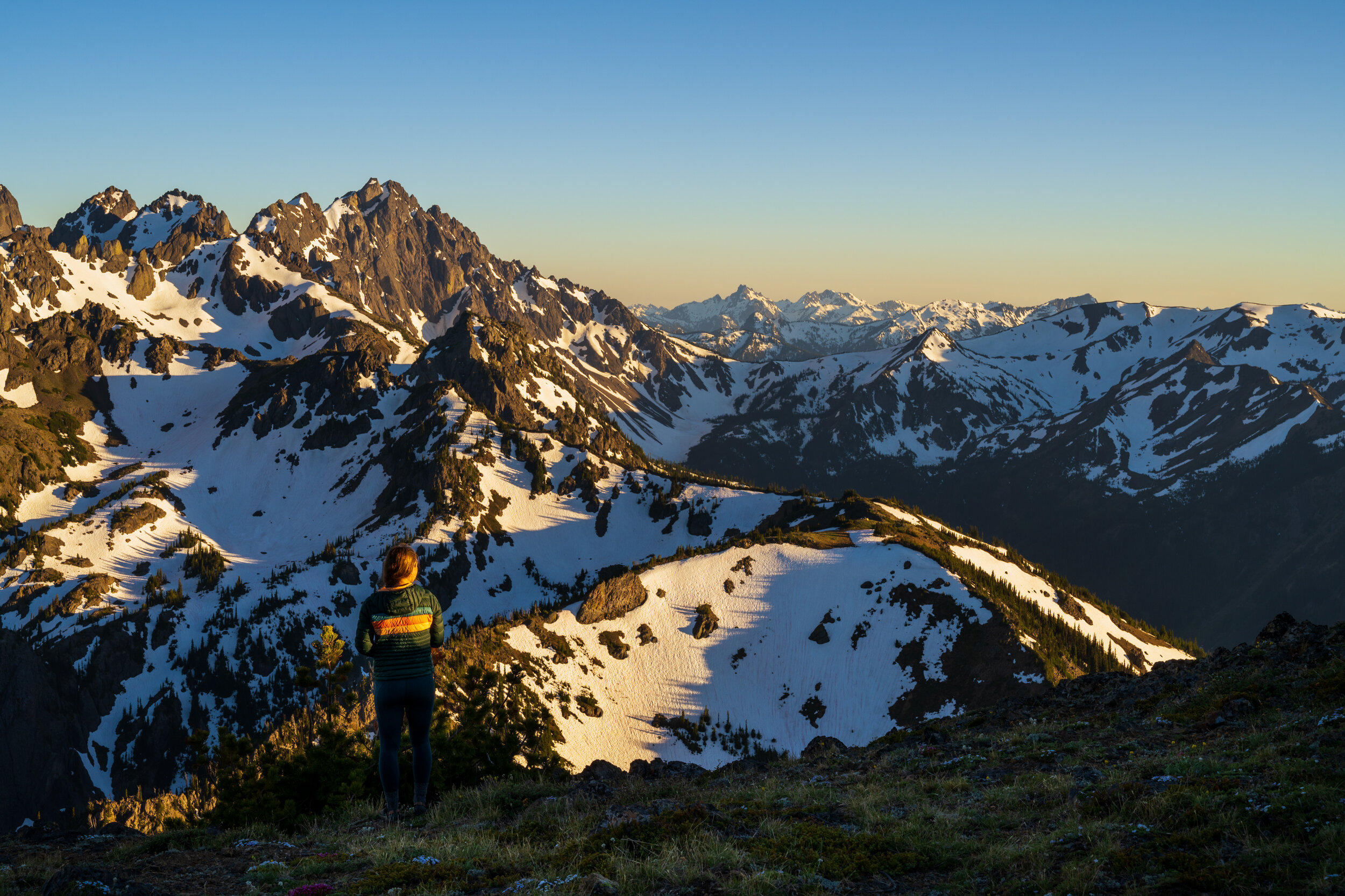
We made our way across copper creek and began the real part of the climb. The trail switchbacks it was through the forest and spits you out on an almost wide open hill side. That’s when you get your first real glimpse of Buckhorn Mountain. You’ll never forget that first glance. As we worked our way to the cutoff for Buckhorn Lake we slowed down and soaked up the sun and views. At 5.6 miles, you will reach the cut-off to the lake. Two creeks and a bit more climbing later, you follow a steep and rooted trail to the lake.
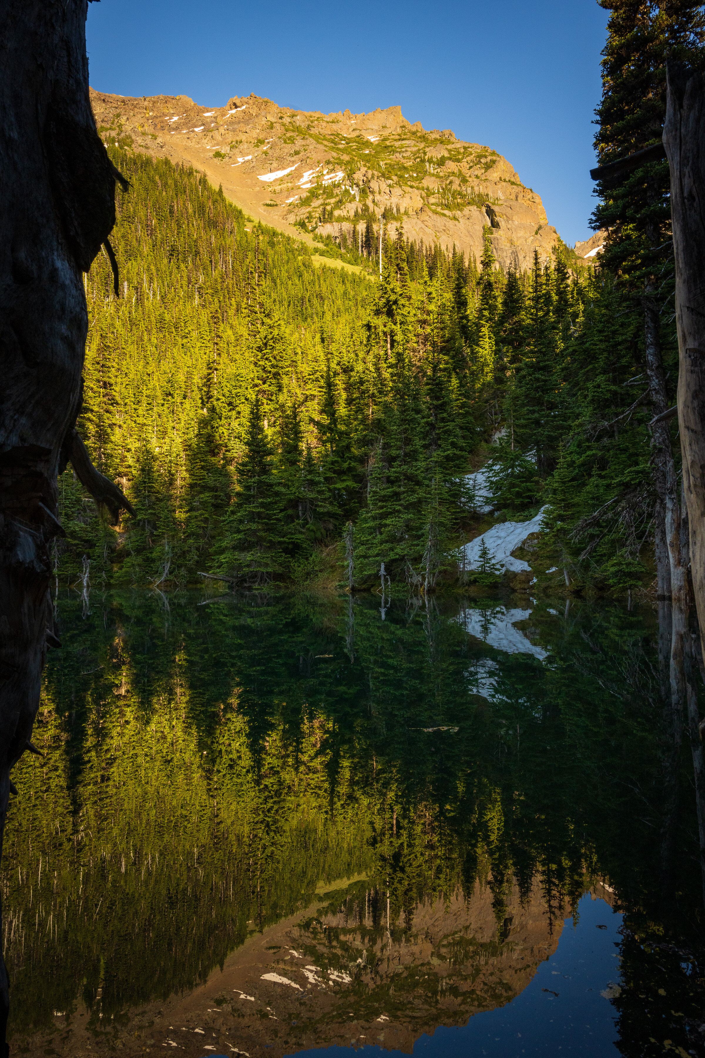
Buckhorn Lake was the highest I have ever seen it. We dropped our packs, set up camp and reluctantly dunked ourselves into the lake. It was a shock to the system. Rinsing off sweat had never been so difficult. After that, we rushed back to change and hang up the sweaty clothes we washed off. Then it was time to make dinner, have a nip of whiskey, and watch the sunset from our tent. That night was a beautiful one. Camped right on the lake, Buckhorn Mountain towering above and the rush of the waterfall that feeds the lake.
Buckhorn Lake to Iron Peak

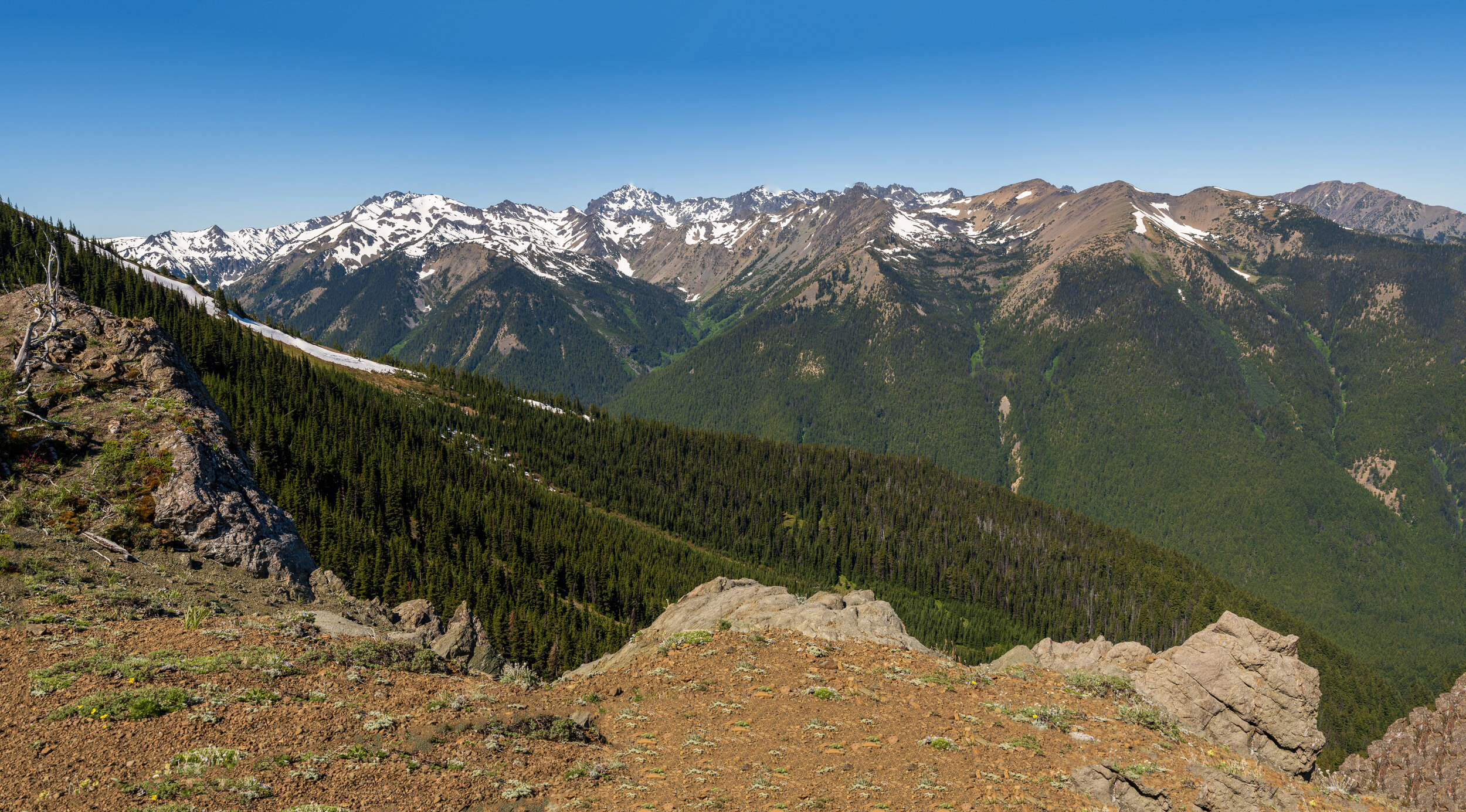
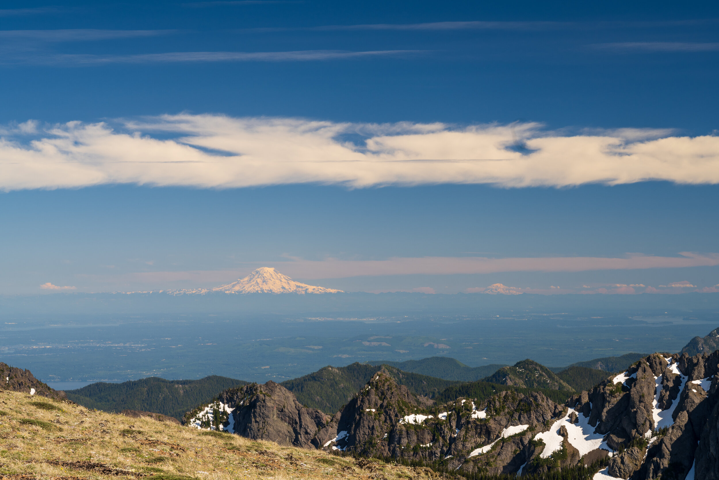
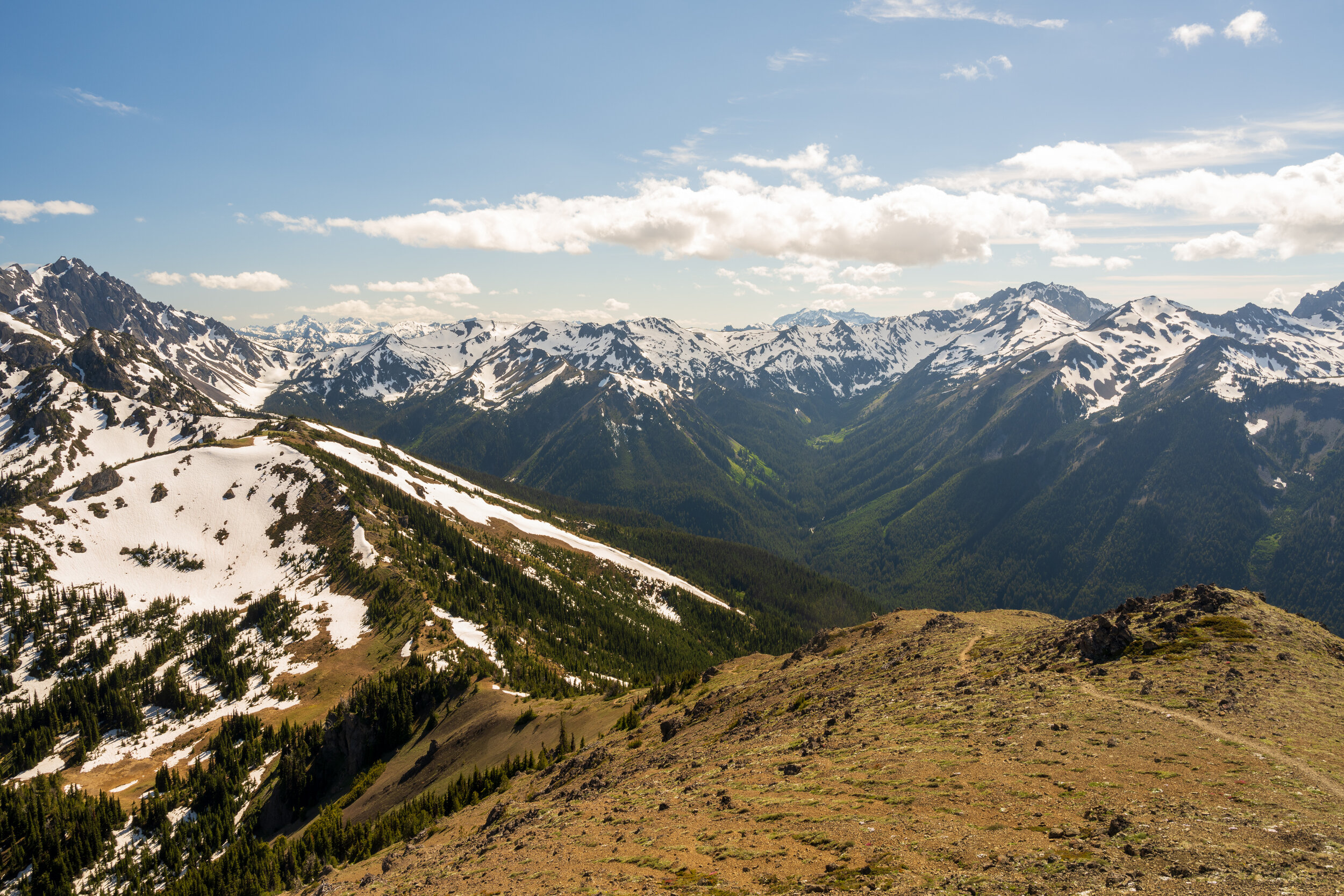
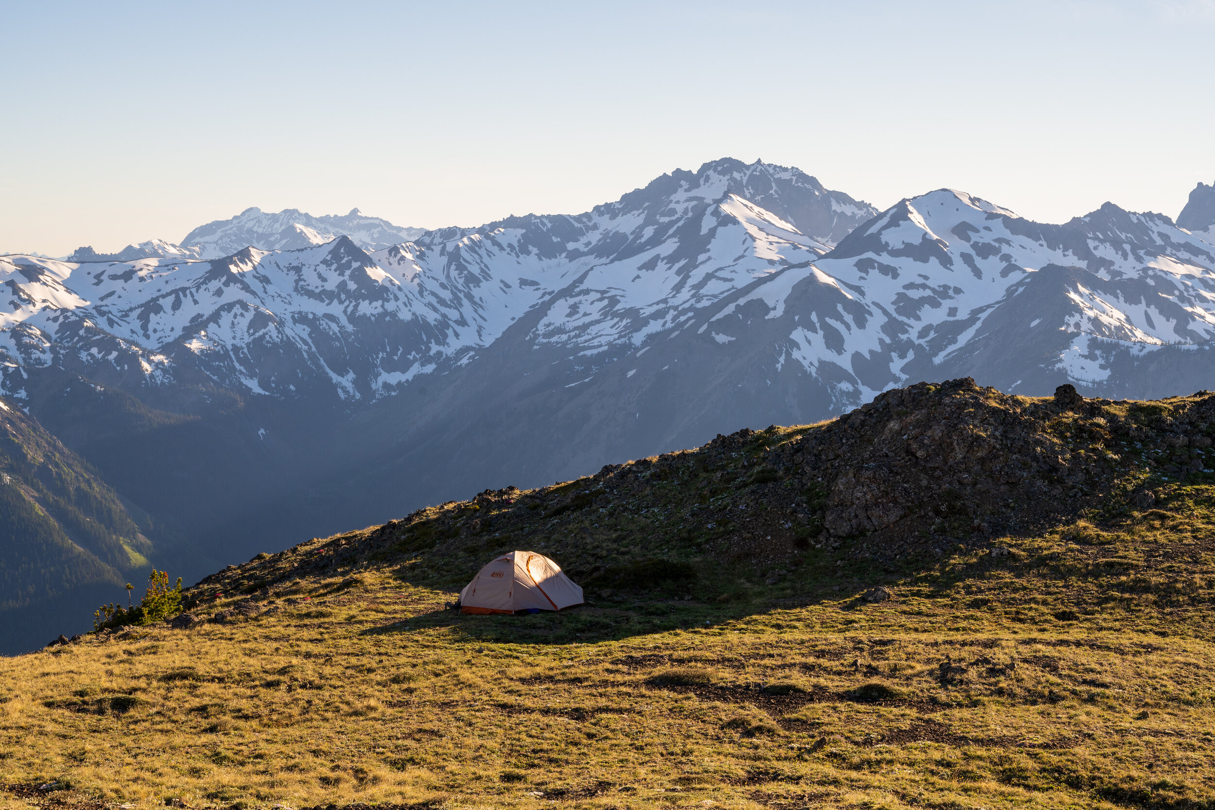
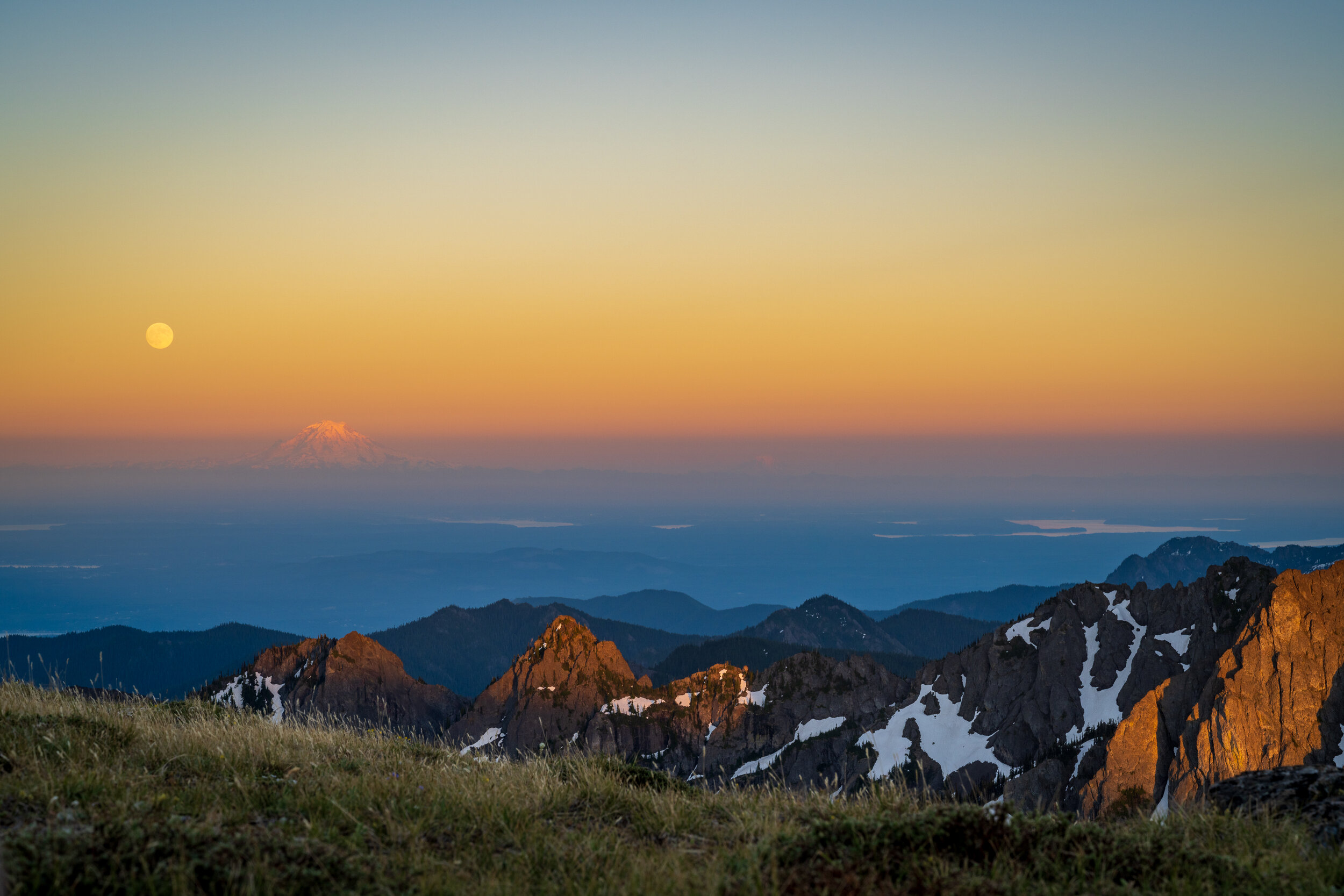
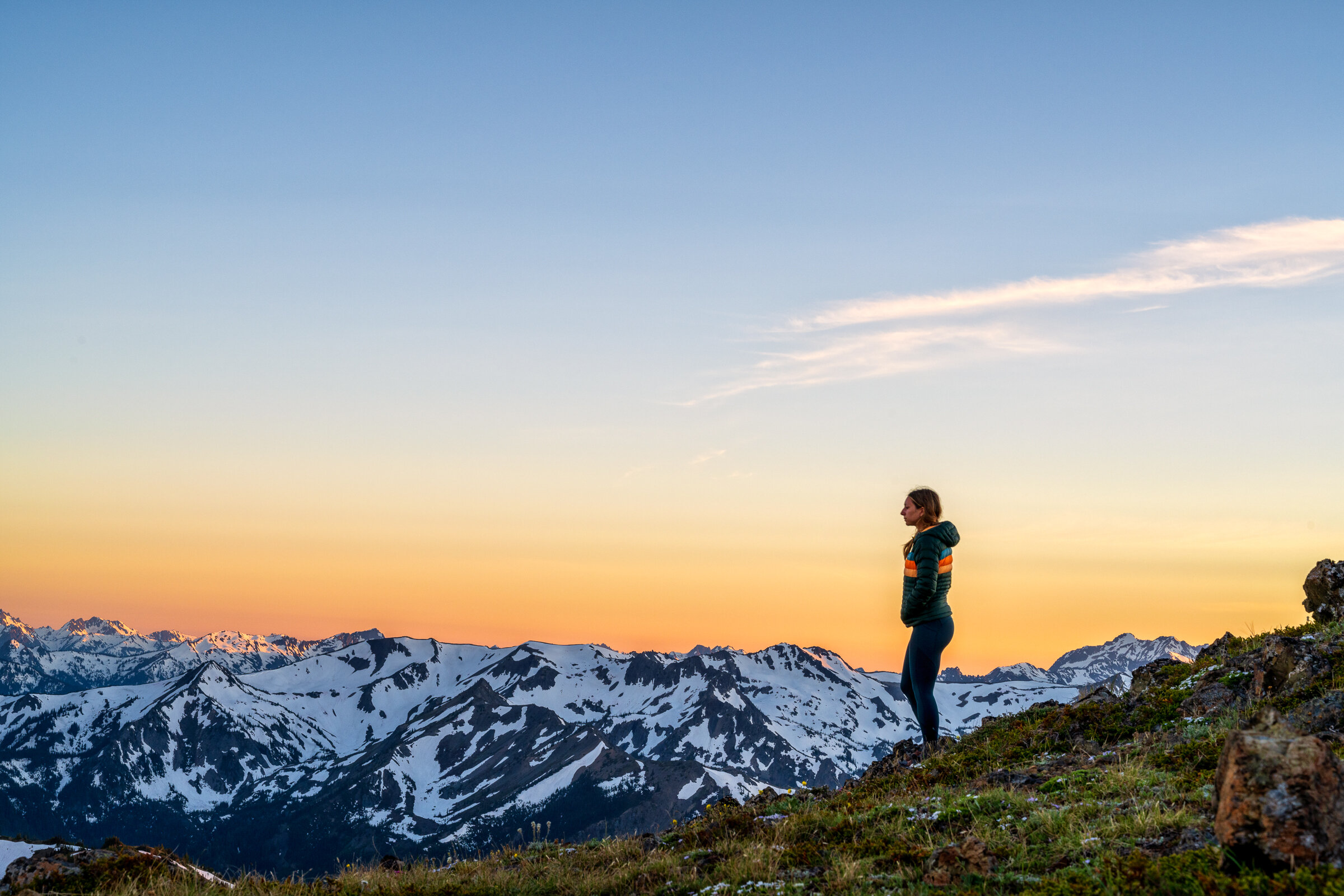
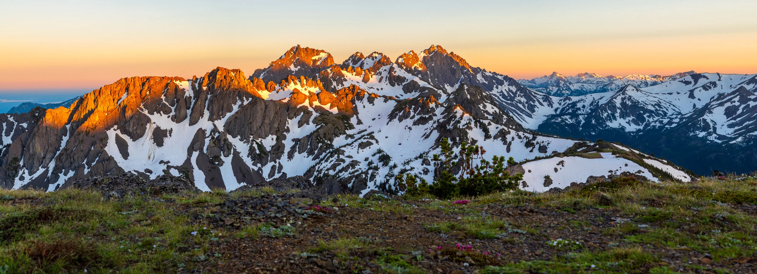
It was a clear morning on the lake. We woke, made coffee, and broke down camp. The original plan was to hike from Buckhorn Lake to the Charlia Lakes. Once again, were back, zigzagging through the trees. After a quick mile and half, you break from the trees and fully witness the majesty that is the Olympics. You have a 360 degree view of the mountains. It’s one of those views you never tire of. Now that we had broken from the trees, the fun begins again. The snow was still covering much of the trail in the higher elevation. Instead of switch backing your way up, it’s a straight climb up the snow and hillside to try and avoid most of the snow. Once you make your way past, you’ll reach the saddle below Iron Mountain. You can see for miles. It was when we were reach the top of the saddle, we realized that reach Charlia lakes was out of the question. Seeing how much snow was still covering the area to the south of Marmot pass, we decided to have a shorter day, and camp on the saddle. That’s okay though. From our tent we could see Seattle, Mount Rainier, Adams, and St Helen’s.
The next morning was an uneventful one. We packed up and headed straight back down to the car. There were swarms of day hikers and the weekend was approaching. We thought it would be best for us to just pick up camp and head back home. We did make it back to the car in just over 2 hours.